We are making decisions about the ocean, how to protect it, restore it, fish it, build in it, on the basis of remarkably little observation. The sea covers seven-tenths of the planet and holds most of its living space, yet it remains the least-known environment we depend on. Closing that gap is one of the great scientific and industrial undertakings of the century, and it runs, at its foundation, on getting the right platforms and sensors into the water. This is the part of the ocean story that gets the least attention and deserves a lot more.
The scale of what we don’t know.
The numbers are genuinely startling. Only about 27% of the seabed has been mapped to modern resolution under the Seabed 2030 programme. Of the deep sea, everything below 200 m, which makes up roughly two-thirds of the planet, we have visually observed a fraction of one-thousandth of one percent of the floor. By the estimates the Ocean Census works from, as many as 90% of ocean species may still be undescribed, and on average around 2,000 new marine species are formally accepted each year. In its most recent year alone (April 2025 to March 2026), the Ocean Census initiative logged more than 1,100 new species across thirteen expeditions, and even that pace is limited by a process in which the average time from collecting a specimen to formally describing it has historically been about 13.5 years. The living ocean is not a solved problem; it is a frontier.
The ecosystems hidden in the deep.
The deep sea is not empty. Seamounts, undersea mountains rising from the abyss, concentrate currents and nutrients and act as biodiversity hotspots and engines of speciation. Cold-water corals build reef structures in perpetual darkness, feeding on plankton and organic matter drifting down from above rather than on sunlight. At hydrothermal vents and cold seeps, entire communities live on chemosynthesis, bacteria turning chemicals from the Earth’s interior into energy, supporting highly endemic species such as the scaly-foot snail, known from just three vent sites in the Indian Ocean. These habitats are ancient, slow-growing and acutely vulnerable to disturbance, which is exactly why baseline surveys and long-term monitoring of them matter before, not after, any human activity reaches them.
The health of the seas we already use.
Closer to home, the picture is one of measured decline. Under the EU Marine Strategy Framework Directive, “good environmental status” is assessed against eleven descriptors, from biodiversity, food webs and commercial fish stocks to eutrophication, seafloor integrity, contaminants, litter and even underwater noise, and across Europe’s regional seas that status has not been achieved on all of them. The Baltic is the stark case: more than 97% of it is affected by eutrophication, and its oxygen-starved “dead zone” has expanded over the last century to roughly 70,000 square kilometres, about the size of Ireland, leaving large parts of the deep seabed without visible life. Meanwhile the EU has committed to protect 30% of its seas by 2030, with 10% strictly protected, against about 13.7% protected and only around 1% strictly protected today. Every one of those targets is, in practice, a monitoring obligation: you cannot designate, manage or defend a protected area you have not surveyed, and you cannot claim recovery you cannot measure.
How marine life is actually measured now.
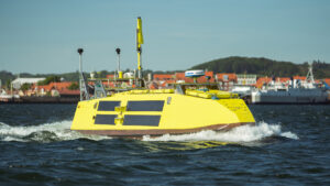
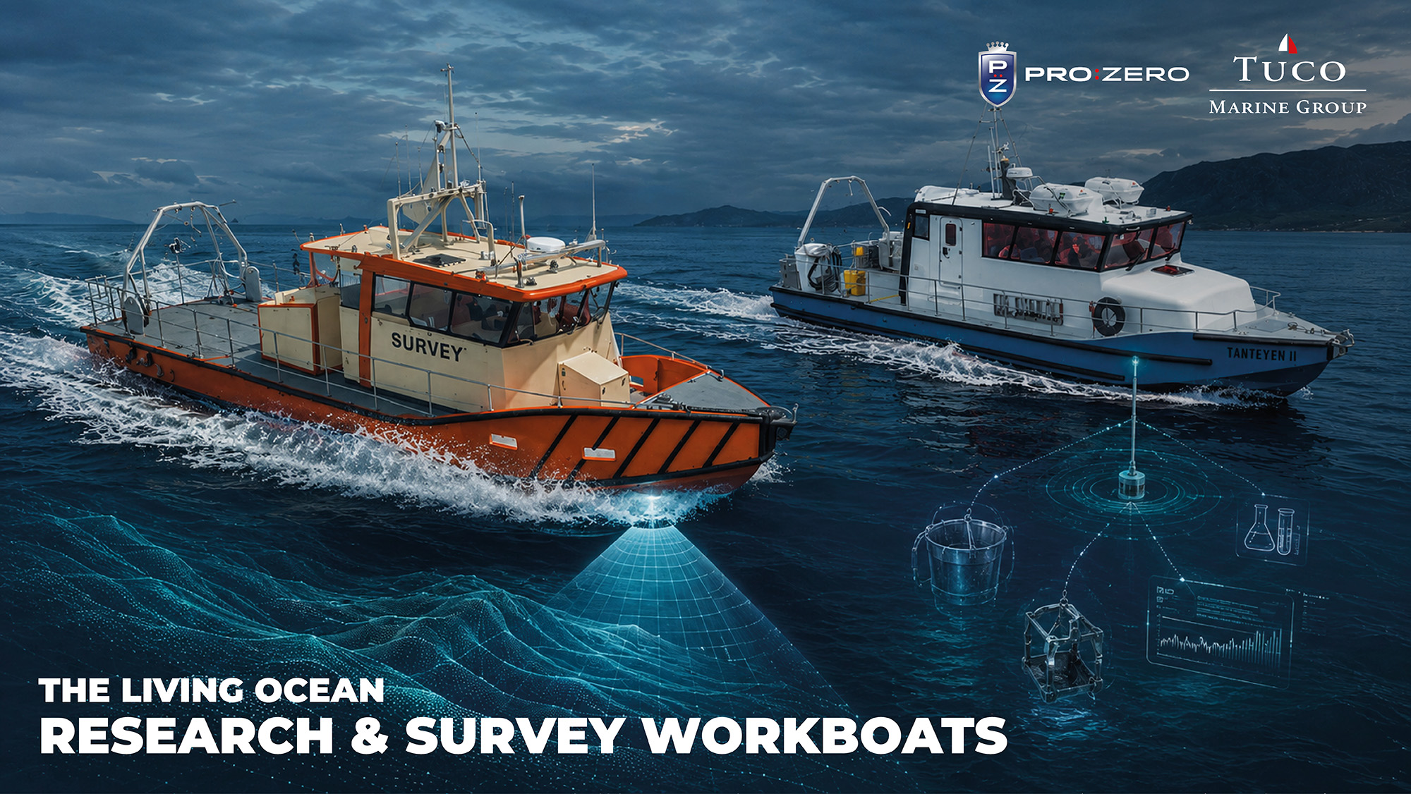
Modern ecosystem work is a layered toolkit, and the platform has to carry and deploy all of it. Multibeam backscatter, the strength of the sonar return, not just the depth, is used to classify the seabed into sand, gravel, rock and reef, producing the habitat maps that underpin conservation. Physical sampling still matters: CTD probes and water-sampling rosettes profile the water column, ADCPs measure currents, and grabs, box corers and sleds recover sediment and the animals living in it. Video and stills from ROVs, AUVs and towed camera systems ground-truth the acoustics. And a quieter revolution is under way in environmental DNA: from a simple water sample, metabarcoding can detect the genetic traces of hundreds of species at once, rare, cryptic and invasive ones included, non-invasively, and increasingly through autonomous samplers that let a platform census biodiversity without a net ever touching the water. None of these replaces the others; together, mounted on a stable, sensor-friendly platform, they turn a stretch of sea into data.
From monitoring to restoration.
Europe has now made restoration a legal duty. The EU Nature Restoration Regulation, in force since August 2024, sets an overall target to restore at least 20% of EU land and sea areas by 2030, and requires listed marine habitat types in poor condition to be brought to good condition across 30% of their area by 2030, rising to 90% by 2050, with national restoration plans due in 2026. Much of the value lies in “blue carbon” habitats: seagrass meadows can store up to around 83 tonnes of organic carbon per hectare in their soils, per unit area up to roughly twice that of a terrestrial forest, and can lock it away for millennia while the meadow persists. But restoring seagrass, oyster and biogenic reefs, or disturbed sediment beds, only counts if you can prove it, which means a survey-quality baseline and years of repeated, comparable observation. That is a platform-and-autonomy problem long before it is a biology problem, the thinking behind Horizon Europe programmes such as DIGI4ECO (a partner is the Oceanographic Institute of Barcelona, ICM-CSIC), which pairs robotic “physical twins” with a digital twin of the ocean to track the 4D recovery of fishery-depleted habitats over time.
From the surf zone to the abyss, one continuum of platforms.
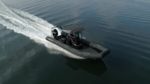
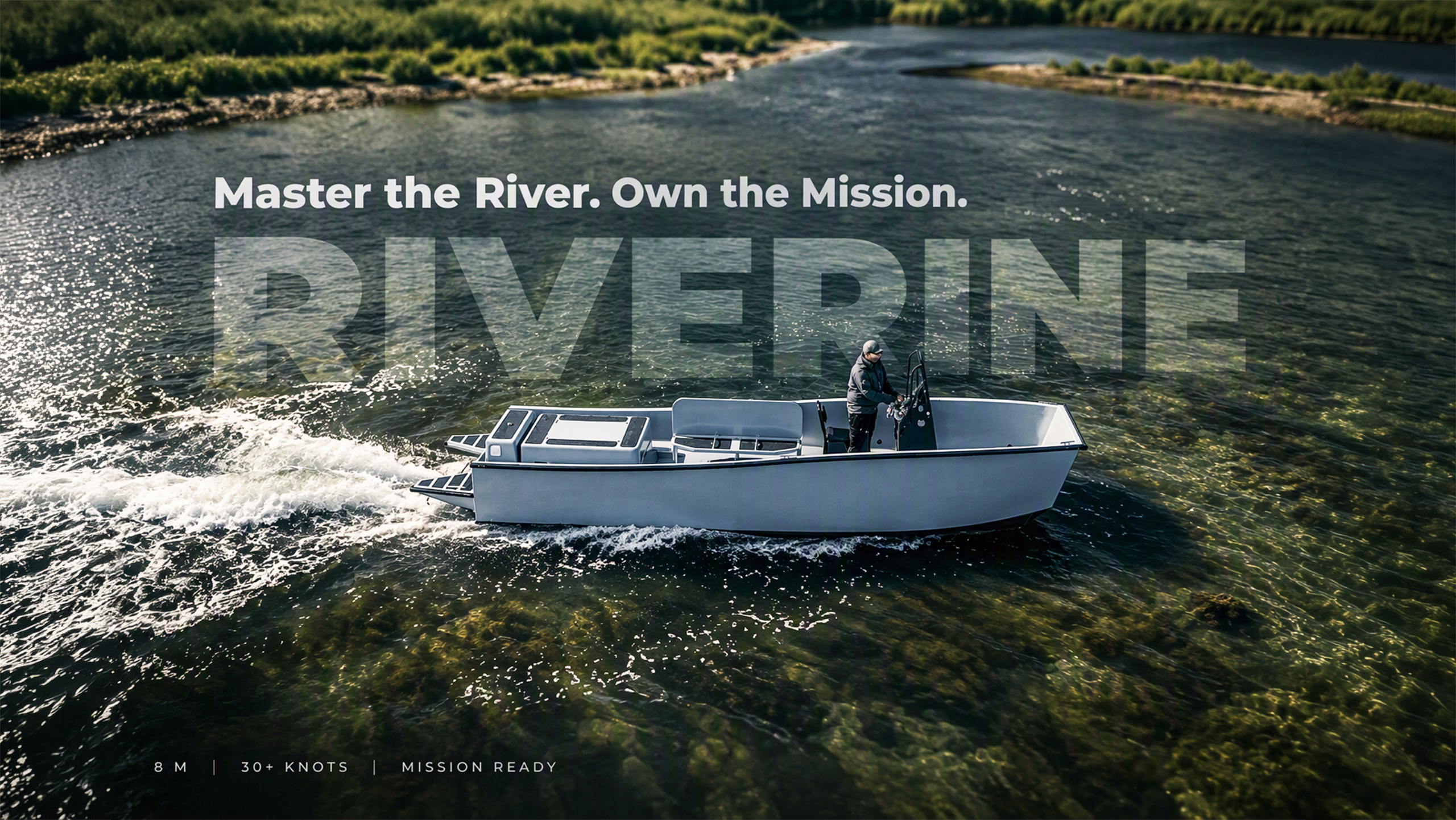
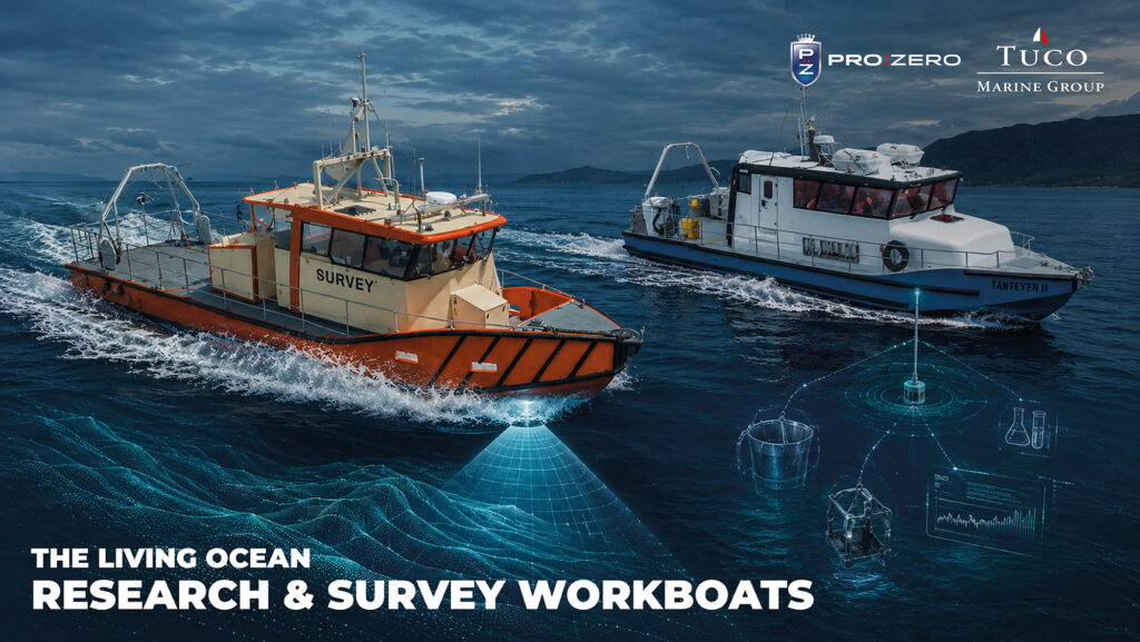
What ties this together is that the science spans an enormous range of scale, and no single hull covers it. Shelf and coastal monitoring, the habitat maps, the eDNA transects, the benthic sampling that feed national and EU obligations, is done efficiently from compact, shallow-draft research and survey boats that can work close inshore and in the shallows. Deep-ocean and expedition science is a different order of operation: large research vessels ranging worldwide, carrying ROVs, AUVs and submersibles rated to thousands of metres. But even at that scale the mother ship does not work alone. Launching and recovering those vehicles, running the fine survey lines, and putting scientists on the water far from the parent hull depend on fast, capable daughter-craft working alongside it, and in poor weather far offshore, the quality and seaworthiness of that support boat is what decides whether an expedition day is productive or lost.
That support platform is precisely where a specialist boatbuilder fits. The deep-sea vehicles, the science and the expedition itself belong to others; the contribution here is the daughter-craft, the light, stiff, sensor-ready, davit-launched boat the whole operation leans on, built to the same instincts that make a good inshore survey platform. It is the same discipline applied at the other end of the scale: from a fjord in half a metre of water to a support boat working the surface above an abyssal plain.
Why it matters.
Marine biology and ocean science are not a niche beside the “hard” business of energy and infrastructure, they are the health check on the system all of it depends on, and they are the least-observed part of it. That combination, a vast unmet need and a legal push to meet it, is precisely why demand for capable, sensor-rich, increasingly autonomous research platforms is rising. The organisms and the ecosystems set the questions; the platform is what makes them answerable. The next part turns to the other side of the ledger, what we build in the sea, and the survey work that underpins all of it.
We are making decisions about the ocean, how to protect it, restore it, fish it, build in it, on the basis of remarkably little observation. The sea covers seven-tenths of the planet and holds most of its living space, yet it remains the least-known environment we depend on. Closing that gap is one of the great scientific and industrial undertakings of the century, and it runs, at its foundation, on getting the right platforms and sensors into the water. This is the part of the ocean story that gets the least attention and deserves a lot more.
The scale of what we don’t know.
The numbers are genuinely startling. Only about 27% of the seabed has been mapped to modern resolution under the Seabed 2030 programme. Of the deep sea, everything below 200 m, which makes up roughly two-thirds of the planet, we have visually observed a fraction of one-thousandth of one percent of the floor. By the estimates the Ocean Census works from, as many as 90% of ocean species may still be undescribed, and on average around 2,000 new marine species are formally accepted each year. In its most recent year alone (April 2025 to March 2026), the Ocean Census initiative logged more than 1,100 new species across thirteen expeditions, and even that pace is limited by a process in which the average time from collecting a specimen to formally describing it has historically been about 13.5 years. The living ocean is not a solved problem; it is a frontier.
The ecosystems hidden in the deep.
The deep sea is not empty. Seamounts, undersea mountains rising from the abyss, concentrate currents and nutrients and act as biodiversity hotspots and engines of speciation. Cold-water corals build reef structures in perpetual darkness, feeding on plankton and organic matter drifting down from above rather than on sunlight. At hydrothermal vents and cold seeps, entire communities live on chemosynthesis, bacteria turning chemicals from the Earth’s interior into energy, supporting highly endemic species such as the scaly-foot snail, known from just three vent sites in the Indian Ocean. These habitats are ancient, slow-growing and acutely vulnerable to disturbance, which is exactly why baseline surveys and long-term monitoring of them matter before, not after, any human activity reaches them.
The health of the seas we already use.
Closer to home, the picture is one of measured decline. Under the EU Marine Strategy Framework Directive, “good environmental status” is assessed against eleven descriptors, from biodiversity, food webs and commercial fish stocks to eutrophication, seafloor integrity, contaminants, litter and even underwater noise, and across Europe’s regional seas that status has not been achieved on all of them. The Baltic is the stark case: more than 97% of it is affected by eutrophication, and its oxygen-starved “dead zone” has expanded over the last century to roughly 70,000 square kilometres, about the size of Ireland, leaving large parts of the deep seabed without visible life. Meanwhile the EU has committed to protect 30% of its seas by 2030, with 10% strictly protected, against about 13.7% protected and only around 1% strictly protected today. Every one of those targets is, in practice, a monitoring obligation: you cannot designate, manage or defend a protected area you have not surveyed, and you cannot claim recovery you cannot measure.
How marine life is actually measured now.
Modern ecosystem work is a layered toolkit, and the platform has to carry and deploy all of it. Multibeam backscatter, the strength of the sonar return, not just the depth, is used to classify the seabed into sand, gravel, rock and reef, producing the habitat maps that underpin conservation. Physical sampling still matters: CTD probes and water-sampling rosettes profile the water column, ADCPs measure currents, and grabs, box corers and sleds recover sediment and the animals living in it. Video and stills from ROVs, AUVs and towed camera systems ground-truth the acoustics. And a quieter revolution is under way in environmental DNA: from a simple water sample, metabarcoding can detect the genetic traces of hundreds of species at once, rare, cryptic and invasive ones included, non-invasively, and increasingly through autonomous samplers that let a platform census biodiversity without a net ever touching the water. None of these replaces the others; together, mounted on a stable, sensor-friendly platform, they turn a stretch of sea into data.
From monitoring to restoration.
Europe has now made restoration a legal duty. The EU Nature Restoration Regulation, in force since August 2024, sets an overall target to restore at least 20% of EU land and sea areas by 2030, and requires listed marine habitat types in poor condition to be brought to good condition across 30% of their area by 2030, rising to 90% by 2050, with national restoration plans due in 2026. Much of the value lies in “blue carbon” habitats: seagrass meadows can store up to around 83 tonnes of organic carbon per hectare in their soils, per unit area up to roughly twice that of a terrestrial forest, and can lock it away for millennia while the meadow persists. But restoring seagrass, oyster and biogenic reefs, or disturbed sediment beds, only counts if you can prove it, which means a survey-quality baseline and years of repeated, comparable observation. That is a platform-and-autonomy problem long before it is a biology problem, the thinking behind Horizon Europe programmes such as DIGI4ECO (a partner is the Oceanographic Institute of Barcelona, ICM-CSIC), which pairs robotic “physical twins” with a digital twin of the ocean to track the 4D recovery of fishery-depleted habitats over time.
From the surf zone to the abyss, one continuum of platforms.
What ties this together is that the science spans an enormous range of scale, and no single hull covers it. Shelf and coastal monitoring, the habitat maps, the eDNA transects, the benthic sampling that feed national and EU obligations, is done efficiently from compact, shallow-draft research and survey boats that can work close inshore and in the shallows. Deep-ocean and expedition science is a different order of operation: large research vessels ranging worldwide, carrying ROVs, AUVs and submersibles rated to thousands of metres. But even at that scale the mother ship does not work alone. Launching and recovering those vehicles, running the fine survey lines, and putting scientists on the water far from the parent hull depend on fast, capable daughter-craft working alongside it, and in poor weather far offshore, the quality and seaworthiness of that support boat is what decides whether an expedition day is productive or lost.
That support platform is precisely where a specialist boatbuilder fits. The deep-sea vehicles, the science and the expedition itself belong to others; the contribution here is the daughter-craft, the light, stiff, sensor-ready, davit-launched boat the whole operation leans on, built to the same instincts that make a good inshore survey platform. It is the same discipline applied at the other end of the scale: from a fjord in half a metre of water to a support boat working the surface above an abyssal plain.
Why it matters.
Marine biology and ocean science are not a niche beside the “hard” business of energy and infrastructure, they are the health check on the system all of it depends on, and they are the least-observed part of it. That combination, a vast unmet need and a legal push to meet it, is precisely why demand for capable, sensor-rich, increasingly autonomous research platforms is rising. The organisms and the ecosystems set the questions; the platform is what makes them answerable. The next part turns to the other side of the ledger, what we build in the sea, and the survey work that underpins all of it.